
Spatial Ventures – Geospatial Services is a registered business since 2006 providing a unique blend of geospatial information management, data science and development services:
MIS/GIS integration – Geoprocessing automation – Web map creation
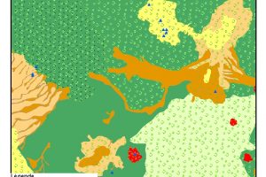
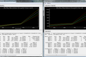
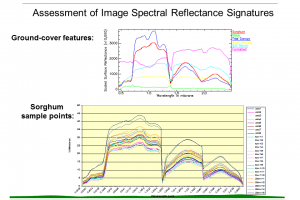
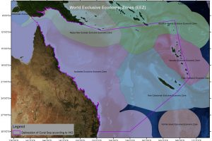
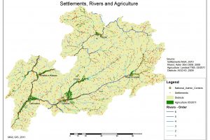
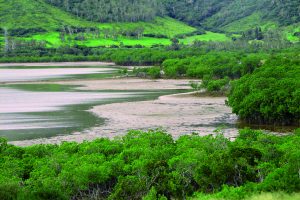
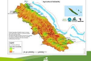
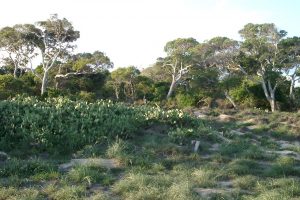
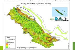
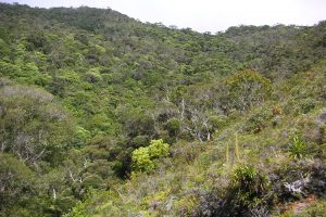
Natural Resource Management – Hydrogeology/Groundwater – Health Geography


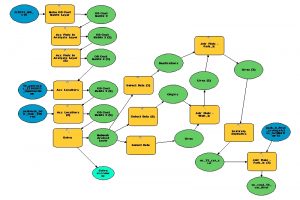

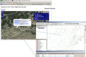


In 2015, we developed the feasibility study for a GIS based national online platform for the Government of Afghanistan funded by the Asian Development Bank. Assessing local information needs helped to shape a MIS/GIS platform concept, where MIS information is enriched with geographic information in order to improve decision support and policy-making.
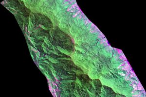
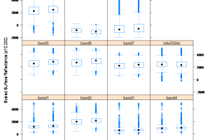
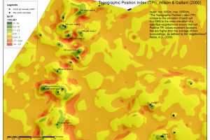
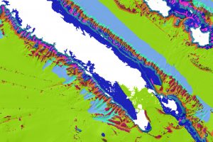
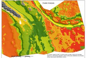
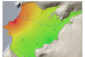
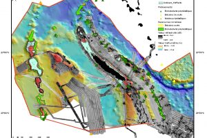
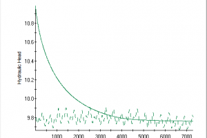
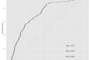
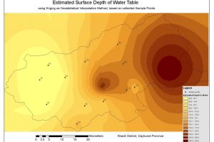
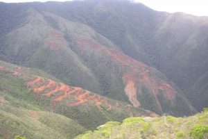
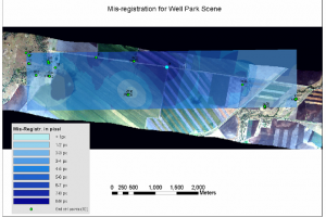
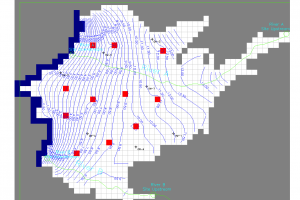
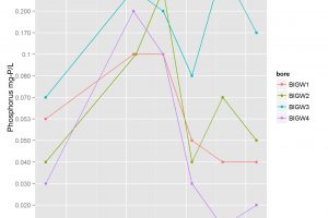
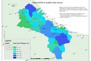
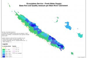
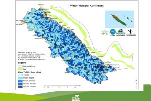
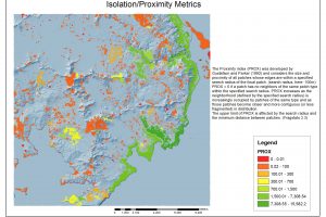
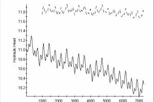
Our assignments with BOM, and Geological Survey of Victoria entailed groundwater modelling and maintaining groundwater data for hosted information systems. Further it included waterlevel timeseries analysis and quality assurance, aquifer-framework assessments & new its renewed conceptualisation.
Health Geography
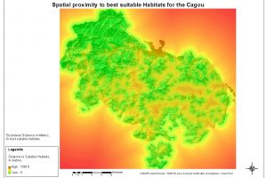
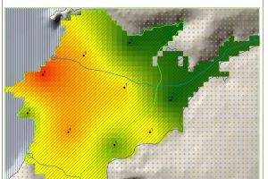
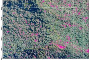
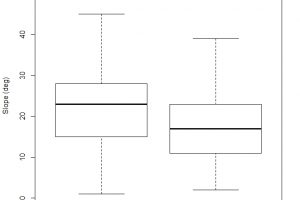
GIS supported assessment of both physical and built environment – their impacts on chronic and infectious disease prevention or containment. The influence on health can be explained through either direct impacts, such as environmental quality, or through effects of built environments on influencing behaviours, requiring an understanding of spatial relations and patterns.
Digital Health/ Electronic Health record analysis
Our management of electronic health records (e.g. U.S. Medicaid) lead us to interacting with aws and mpp (massively parallel processing) database platforms: Assessing
• geographic variations in medication adherence schemes of Medicaid enrollees with Type II diabetes;
• Mental health hospitalisation and costs associations with residential mobility
• Telehealth utilisation and impact on behavioural health issues
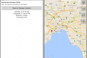
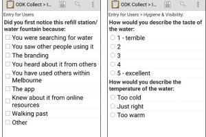
Mobile Field data collection & hosting
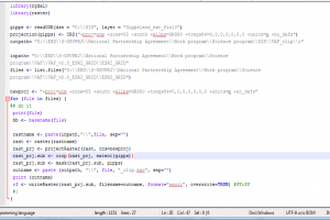
We develop GPS based field surveys and design mobile forms (e.g. ODK) with submission to our spatially enabled database-servers.
Capacity building
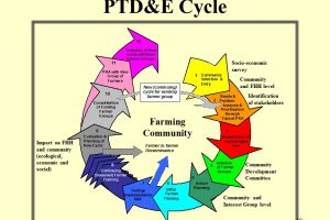
We are well experienced in GIS/Remote Sensing capacity building, developed training materials, especially in the context of institutional and rural/community development.
Spatial Ventures – Geospatial Services (ABN 48 095 813 963)