Expertise in geospatial and statitstical analysis, modelling, and data management
through engagements with CSIRO/Ecosystem Science, Geological Survey of Victoria, Bureau of Meteorology (BOM), Queensland Department of Natural Resource and Deakin University Melbourne.
Examples of international assignments are spatial planning, GIS application development and capacity building for Conservation International, Afghan Ministries of Agriculture (MAIL) and Rural Development (MRRD), the Libyan Environmental Government Agency in 2009 as well as national feasibility study for a GIS-platform for the Asian Development Bank (2015).
GIS service provision
|
Project assignments
- Needs Assessment for a GIS-based Information Platform on national level for the Afghan Government – a feasibility study for the Asian Development Bank (2015) – launched March 2018
- Health Geography: neighbourhood analysis, network analysis, geocoding automation;
- 20-minute neighbourhood study (& map); Food access study – Deakin University, Faculity of Health;
- Spatial analysis investigating medication adherence and geographic variation of Type2 Diabetes – Univeristy of Canberra, HRI
-
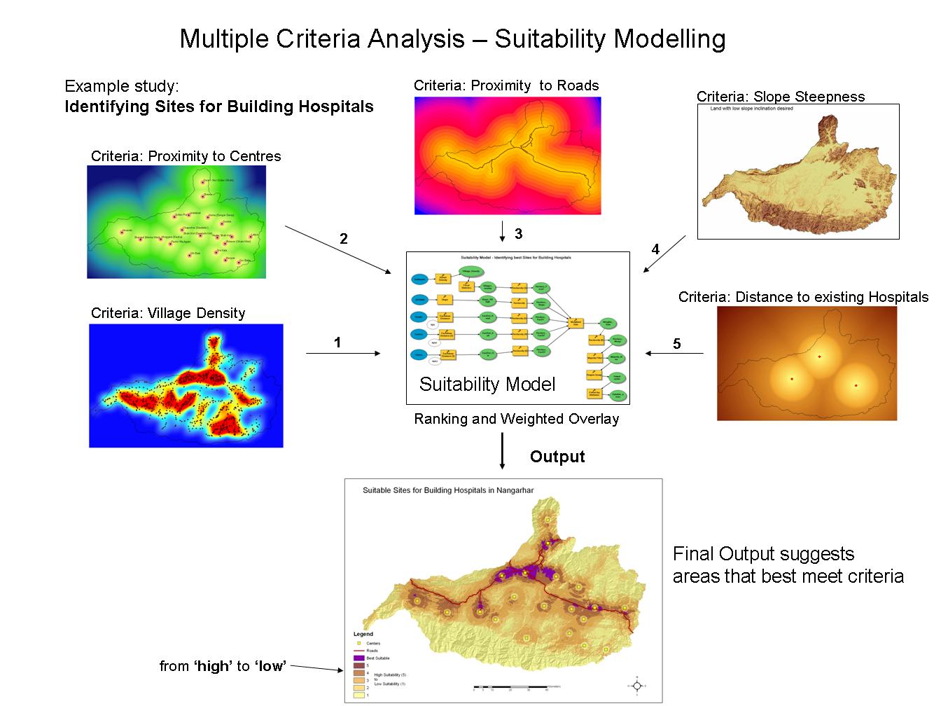
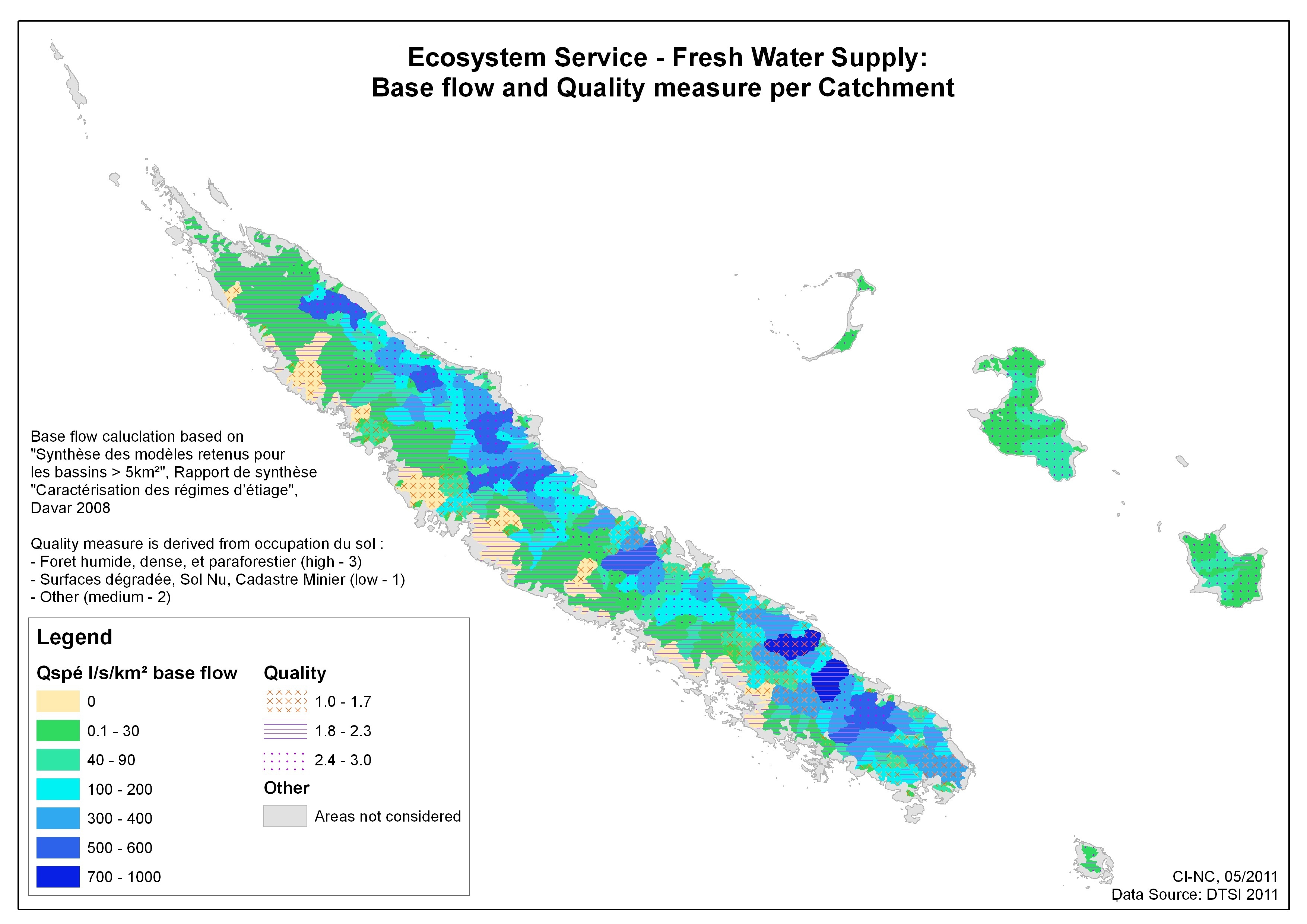
 Suitability/ multi-criteria analysis, cost distance modelling, hydro-ecological modelling (e.g. catchment and flow analysis),
 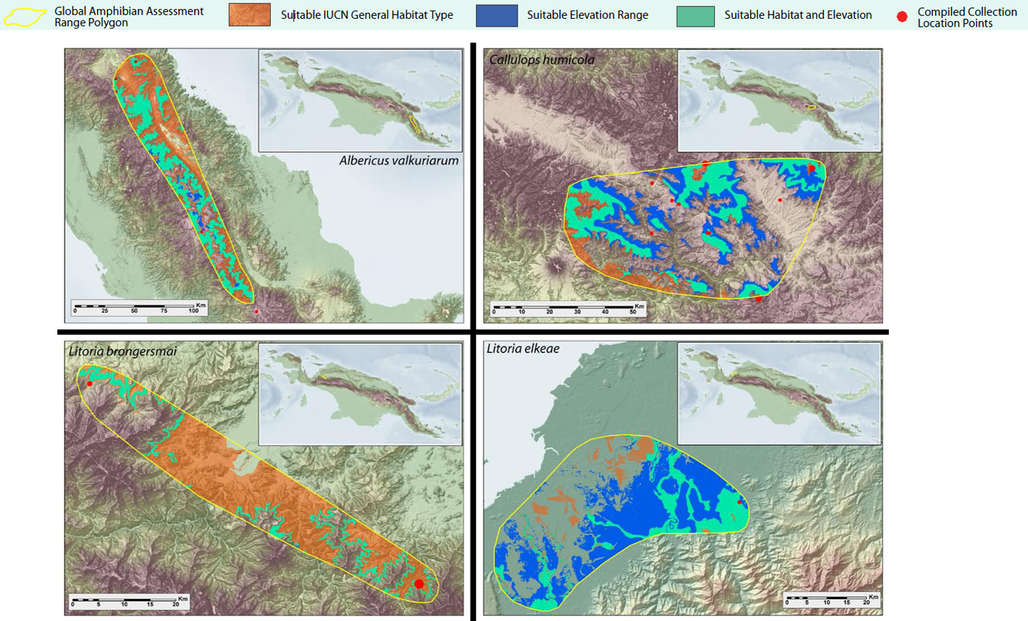 habitat mapping
 - Nested water-catchment design based on restricted area ranges
- Conservation Planning:
 Mapping Ecosystem Services, and Delineation of Key Biodiversity Areas (
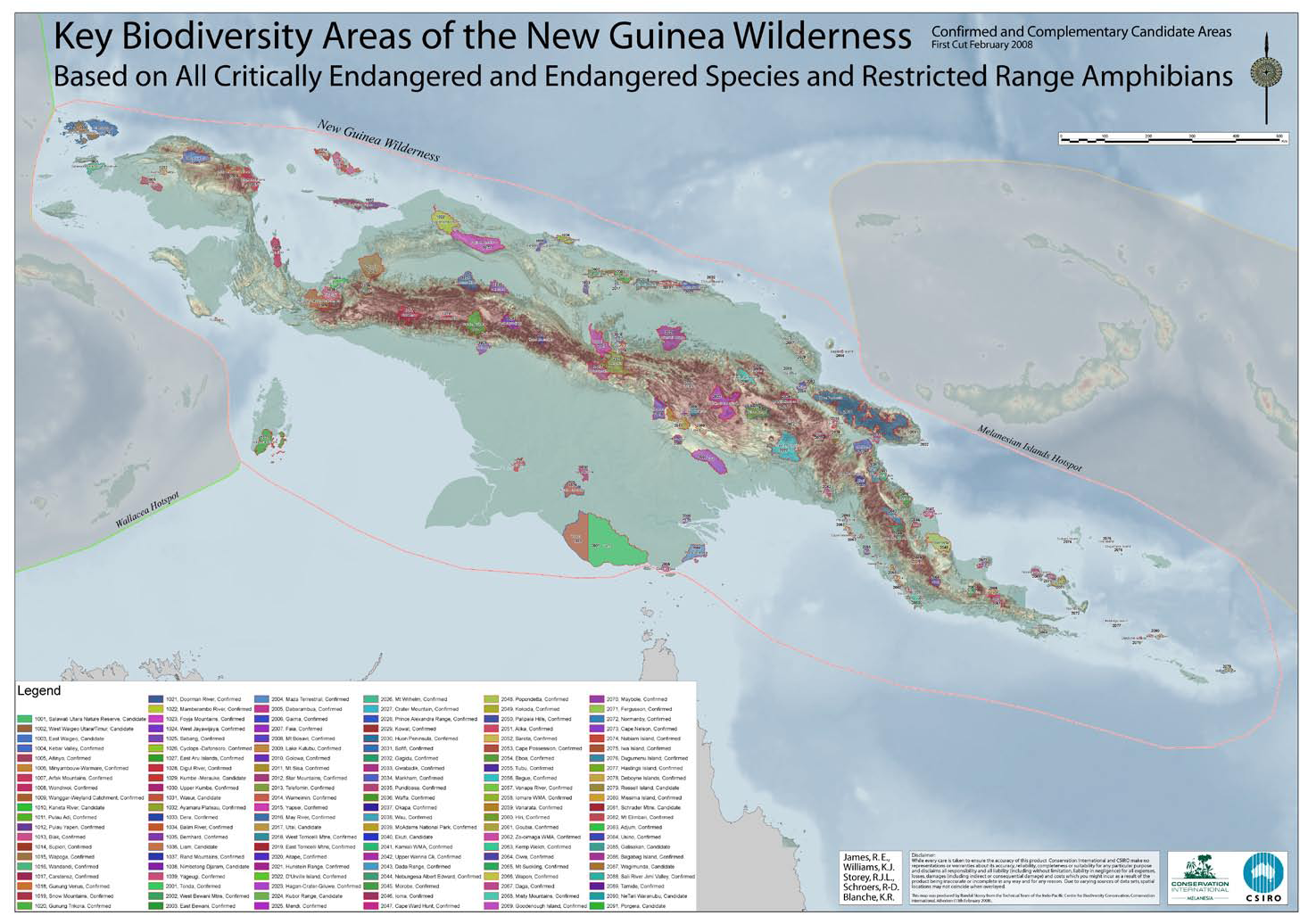 KBA Papua map; NC report pdf )


- Cluster Analysis of geomorphology (e.g. in
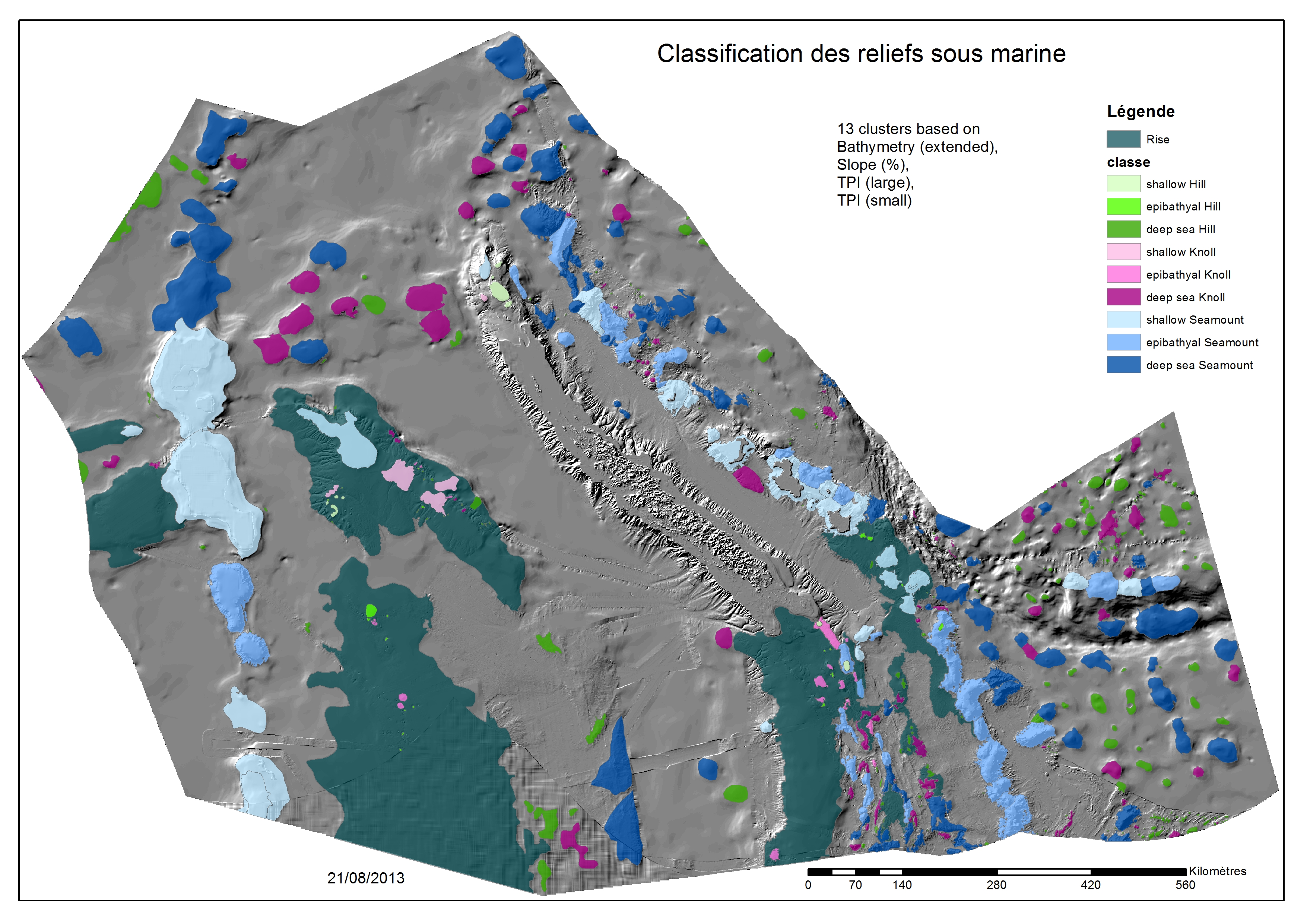 Marine Spatial Planning; webmap; documents)
 - Corridor analysis, assessing landscape fragmentation and connectivity in Le Grand Sud / New Caledonia (2010/2011)
- Community engagement:
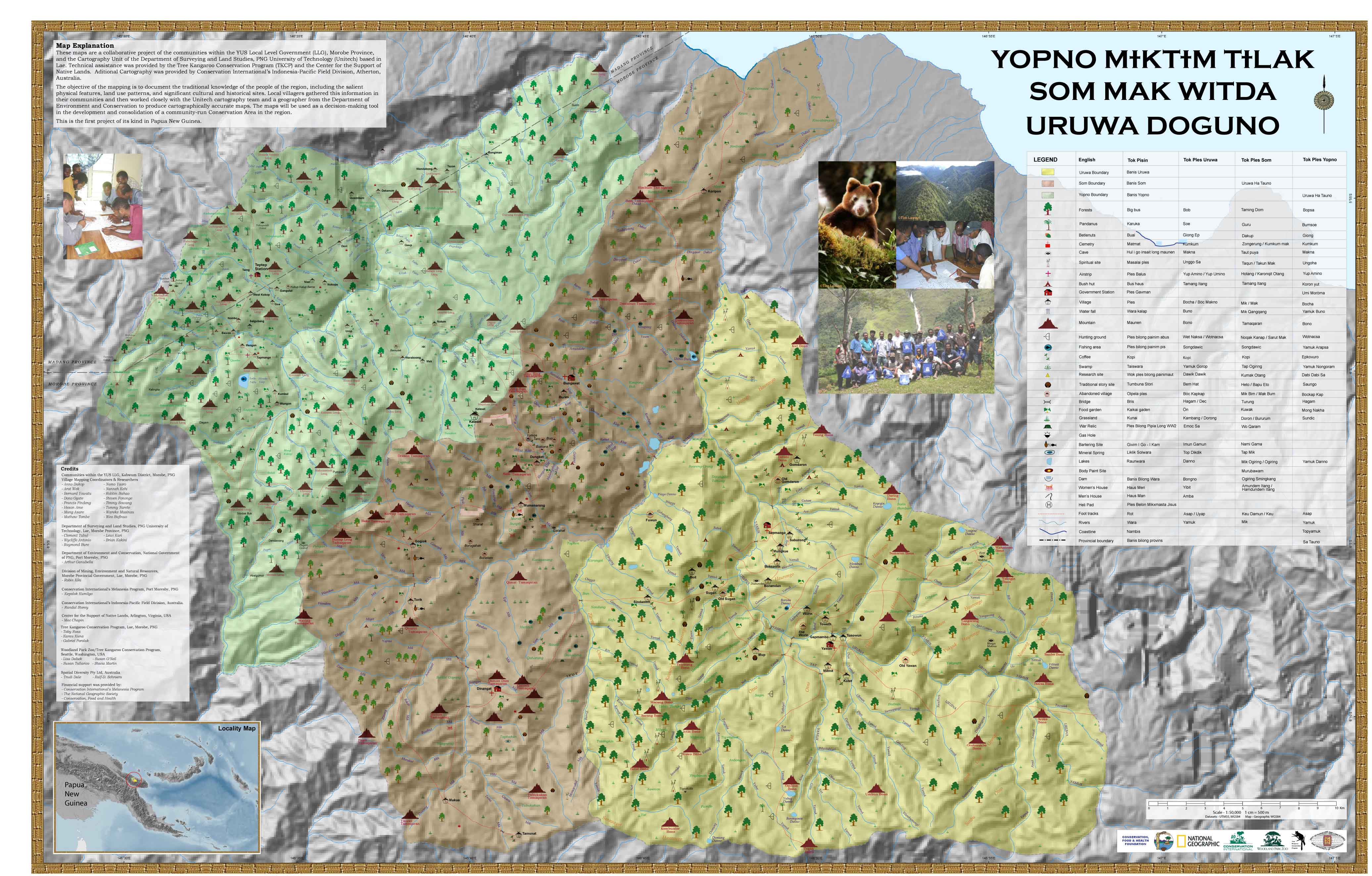 Community maps for the Tree Kangaroo Conservation Program
 - Cartography and metadata documentation (ANZLIC)
Further specialisations
- Spatial data preparation and model input support (e.g. Groundwater model input)
- Scripting applications and statistical analysis (customized solutions in Python, R, VB)
- Spatial database development, management and integration (MS SqlServer, Postgres/Postgis, Mysql)
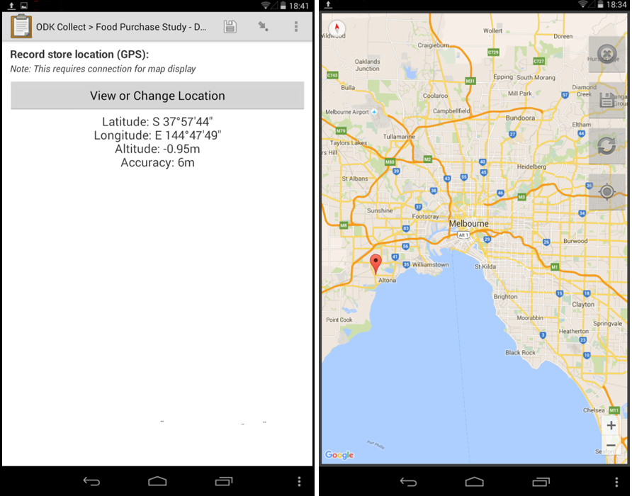
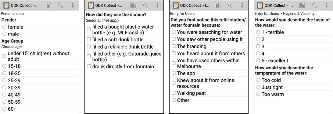
- Mobile field data collection, survey form design and processing (e.g. ODK)
– with submission to our spatially enabled database-servers