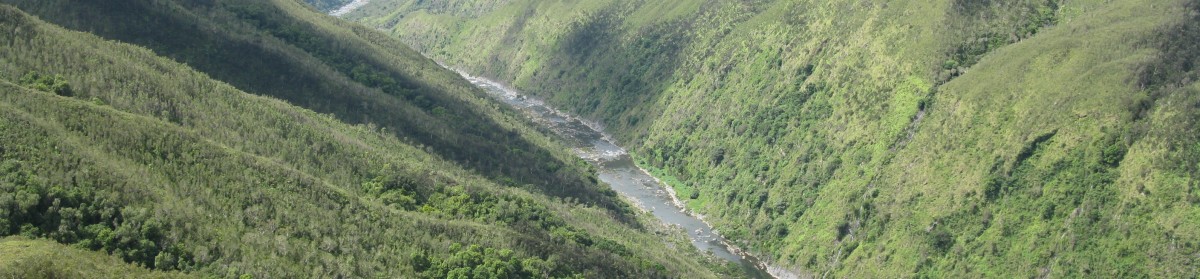
Spatial Ventures designed a variety of webmapping applications, mainly using Geoserver & Openlayers, but also ArcGis Online.
Lately, we have been developing webmaps based on Openlayers 3 (up to v8), in combination using jquery/ajax based database server requests. Automated zoom and getfeature information with ‘on-click’ events are implemented,
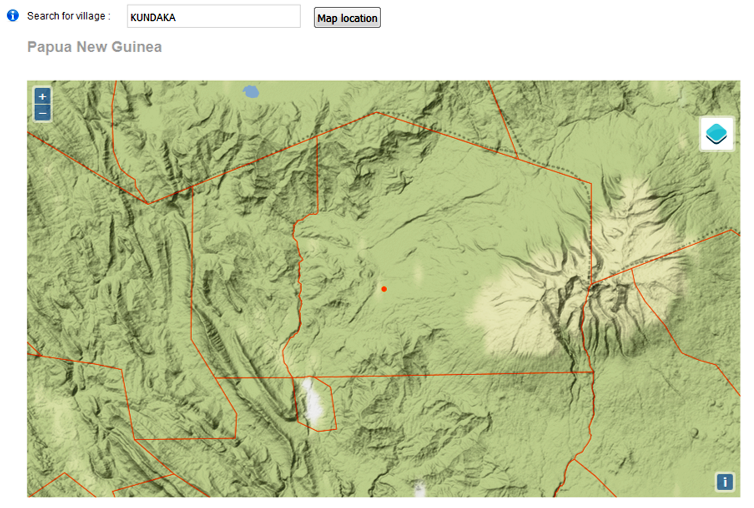
see a demo for the PNG-Region.
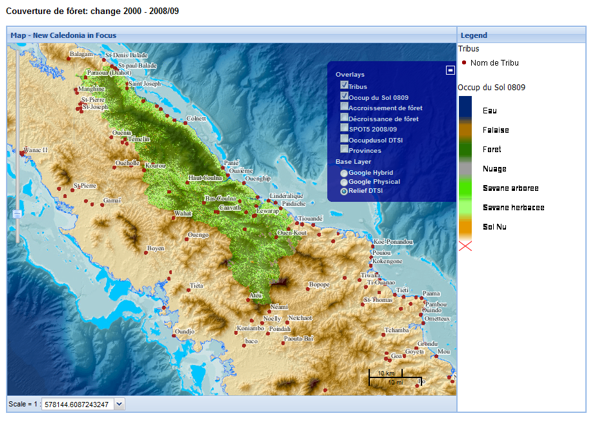
Below Web mapping demonstration is built on Geoserver, Openlayers & Geoext, using vector and raster layers
(GeoTiff & ErdasImg formats, ArcGis Rest and Google Maps):
Principles of browser-based data entry based on Web Feature Service (WFS) are a shown here as a way of capturing GIS information through a simple browser interface, handy for non-technical office personnel.
Below a Open-Source Application for the Government of Afghanistan in 2011, to collect rural information from provincial govmnt. offices, based on Geoserver and Openlayers:
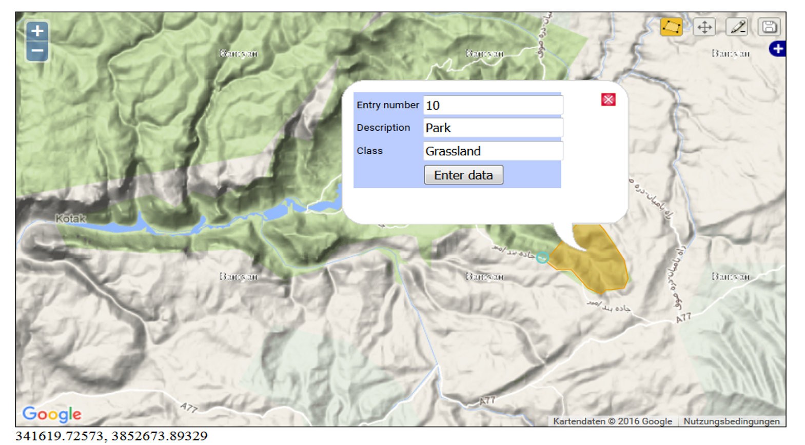
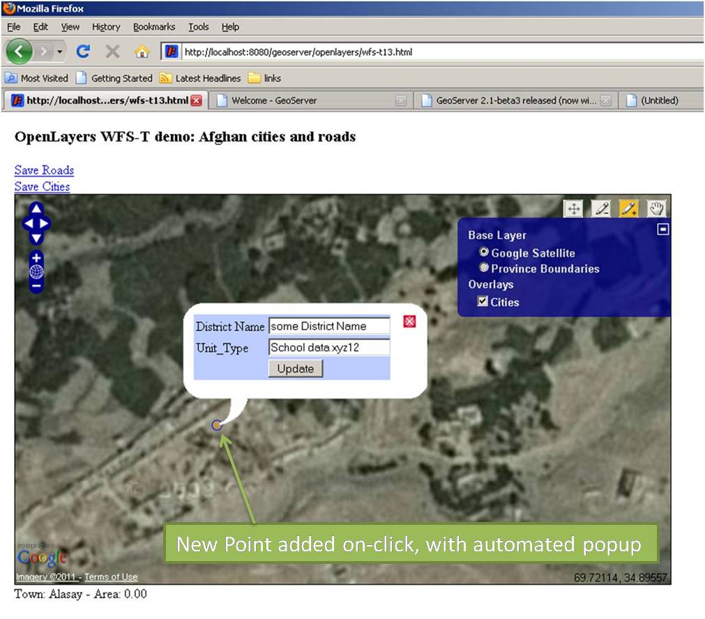

A test version is available here.
The early days –
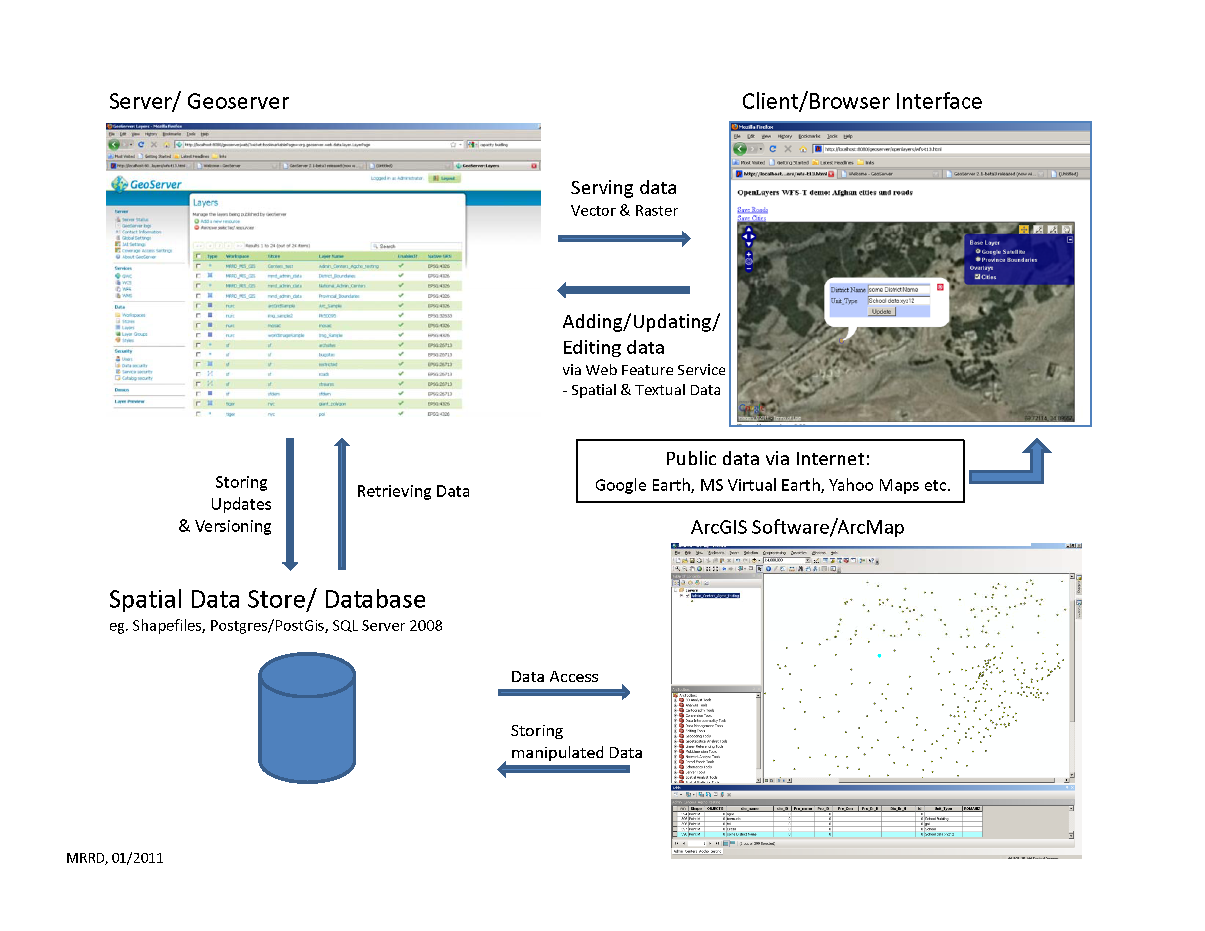
Integrating GIS and textual MIS information through ArcGis Server and MS SqlServer
– delivering a webbased mapping platform for the Minsitry of Rural Rehabilitation and Development (MRRD), Afghanistan in 2009/10.
‘On-the-fly’ ArcServer and SqlServer data linkage, implemented in .net (VisualStudio), visualising country-wide project development data.
Workflow:
Sql-User request (according to Filter) => Result/Data aggregation from SqlServer =>
Classification in ArcGis Server (ClassBreaks) => Creation of a colour-shaded GraphicsLayer as backdrop.
Map-tips showing polygon feature related detail, mouse-clicks are triggering SqlServer request and display.
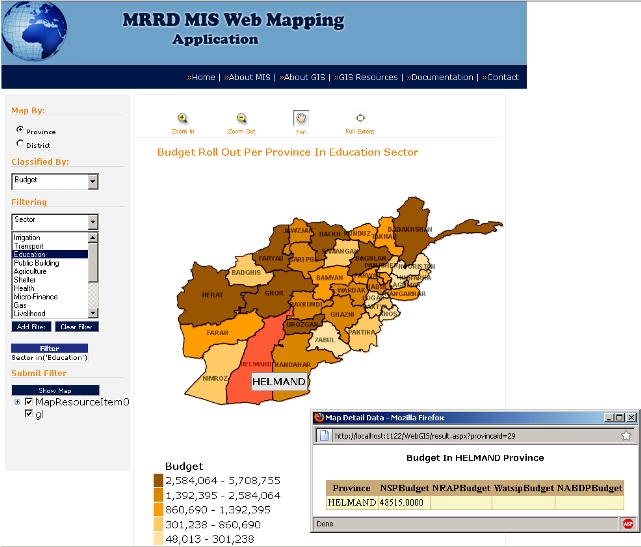
These days way easier to implement with ArcGis Online.