Our remote sensing work has been undertaken with the QLD Department of Natural Resource, CSIRO Sustainable Ecosystems, Conservation International Melanesia, Ministries of Agriculture and Rural Development Afghanistan.
The scope of our work with image interpretation, analysis and manipulation covers:
- Image classification, e.g. delineating land cover classes
- Change detection (Webmap: Forest cover change New Caledonia and Bulletin pdf)
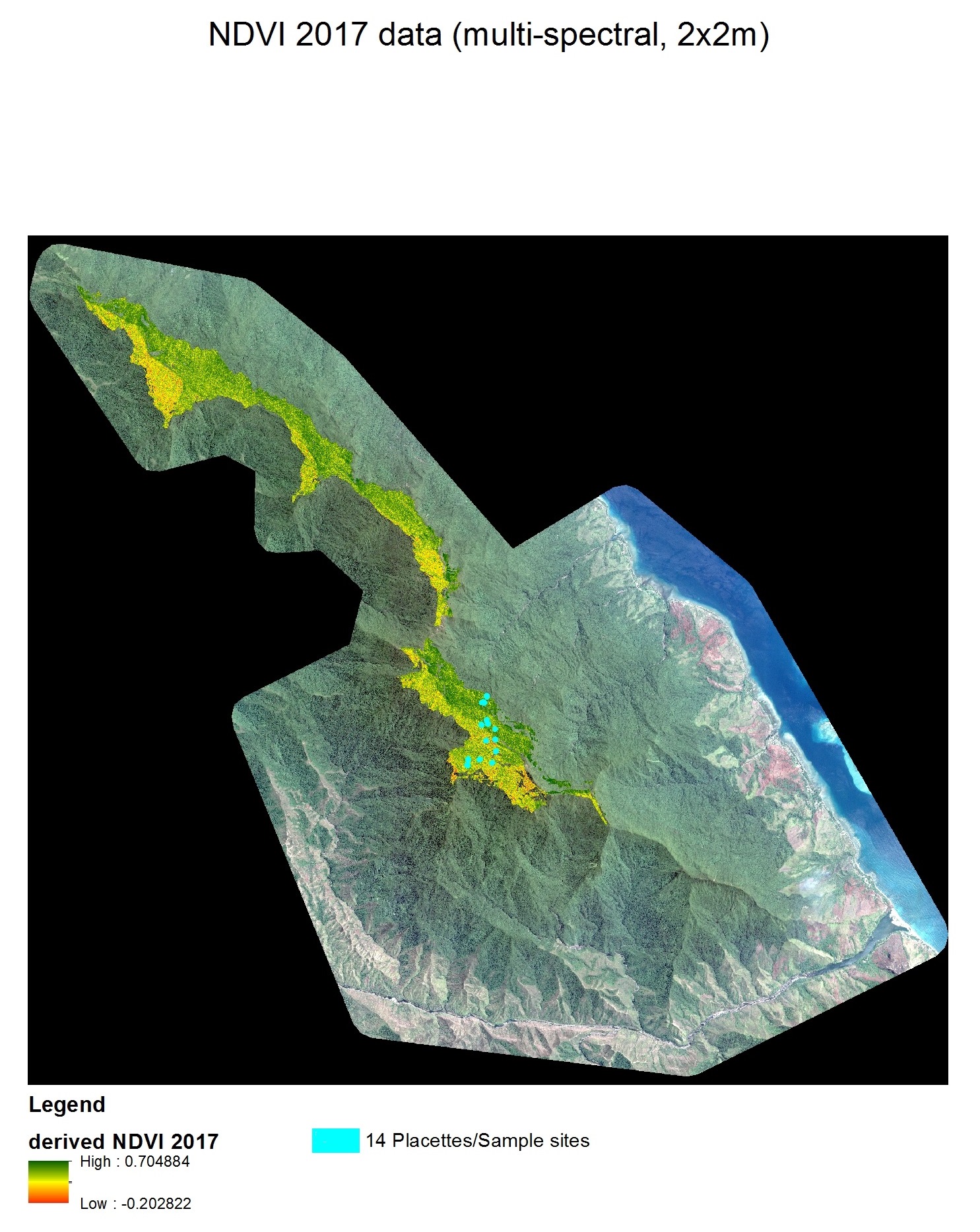
- Plant vitality analysis/mapping, e.g. vegetation indices such as NDVI, EVI
 Monitoring Kauri tree die-back
 - Time series and statistical analysis (R)
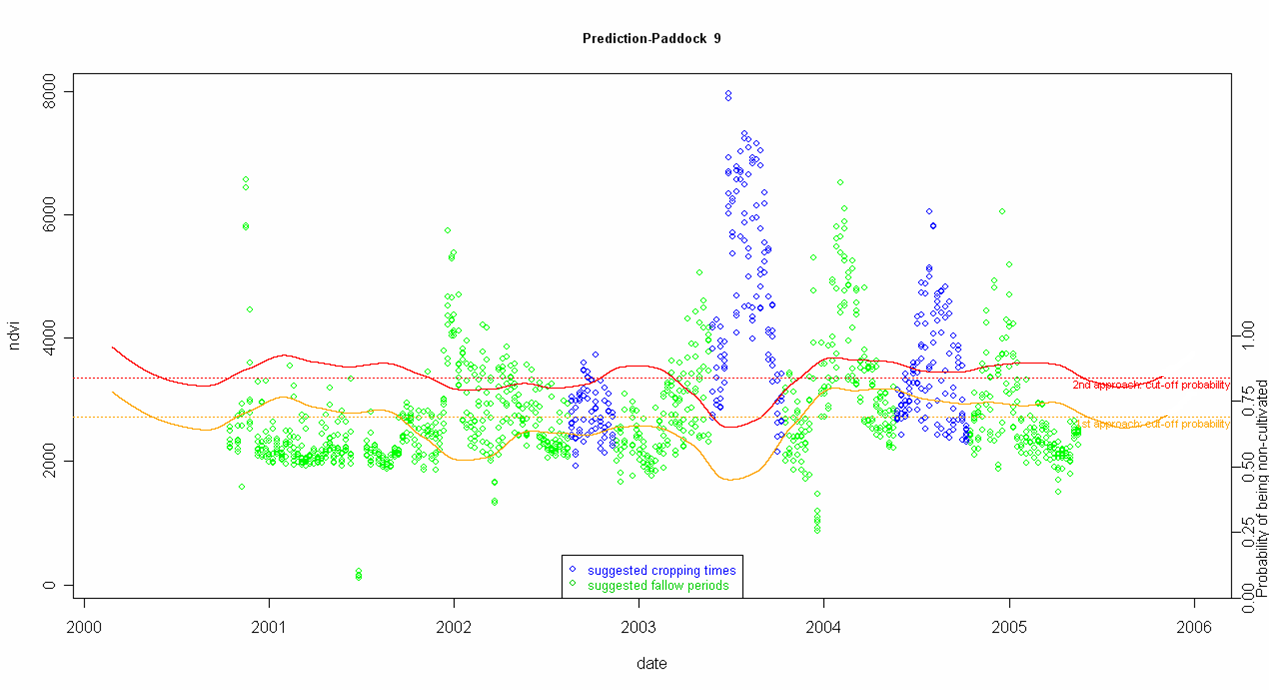
- Prediction models, e.g. yield estimation,
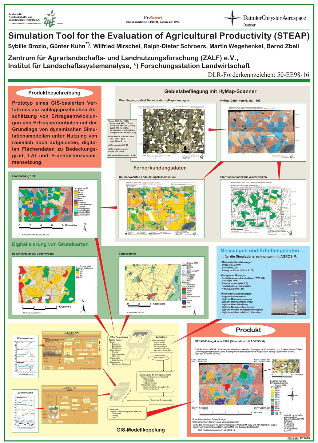 agricultural productivity
 - Habitat mapping (Example Papua New Guinea)
- Spectral mixture analysis
Common Image processing & analysis tasks are performed with either Erdas, Envi, R (e.g RandomForest) or python based libraries (e.g. gdal, RSGISLib).
The illustration below shows a time series analysis of employing approx. 6 years of weekly/fort-nightly Modis images estimating agricultural land management practices in Southern Queensland.